Home · Walks & essays · England-wide
Notes on maps
How to read an Ordnance Survey map without getting lost in the symbols
Grid references, contour lines, right of way colours and the handful of OS symbols you actually need on a day walk, with a quiet case for paper.
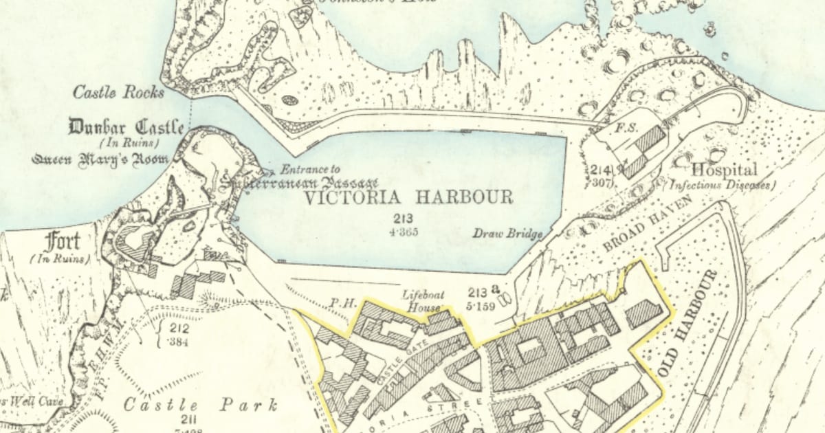

A paper map does not run out of battery, does not need signal, and does not insist you turn right now. It also, usefully, lets you see the ground around you instead of only the next instruction. This is a short beginner’s guide to the Ordnance Survey (OS) maps that cover every square foot of Britain, and the few symbols that genuinely matter on a day walk.
Which map to buy
For walking in Britain there are two main OS series. The orange-covered Explorer is 1:25,000, four centimetres to a kilometre, and shows field boundaries, rights of way and small detail. The pink-covered Landranger is 1:50,000 and covers more ground at less detail. For a day walk, nearly always buy the Explorer.
Explorer sheets are numbered. You will often see them referred to by sheet name (‘OL2 Yorkshire Dales South and West’) rather than number. Two-digit sheets starting with OL are Outdoor Leisure sheets, the same scale with a tougher cover, covering National Parks and other heavily walked areas. There is no quality difference between an Explorer and an OL beyond the cover.
What the colours mean
Three things on an OS Explorer map are worth getting into your head before anything else:
- Green dashes on the open map are public rights of way: short dashes are footpaths, long dashes are bridleways, red dots and dashes are byways. These are the paths the public has a legal right to walk, ride or cycle along.
- Orange shading is CROW access land, open country where you may walk on foot off the path.
- Pink bands around land marked ‘Access Land’ are permissive routes that the landowner has agreed to make available.
A black dashed line is a boundary or a non-public path; it is not an invitation. A thin red line is a minor road.
Contour lines, in plain English
Contour lines are the brown wavy lines on the map. Each one joins points of the same height. On an Explorer sheet, every line is five metres of height, and every fifth line (a darker brown) is 25 metres. Two things follow:
- Where contours are close together, the ground is steep.
- Where contours are far apart, the ground is gentle.
The quickest way to pick up contours is to compare two short sections of a walk. On a route you know, trace the climb with a finger and count the lines you cross. You will quickly get a feel for how a ‘five-contour pull’ feels in the legs.
Grid references
Britain is covered by a grid of 100 km squares, each lettered, and each square is divided into a thousand smaller squares a kilometre across. A six-figure grid reference points to a 100-metre box; an eight-figure reference points to a 10-metre box. The way to read a six-figure reference is simple: along the corridor first, then up the stairs, with a 1-9 within each square estimated by eye.
The grid letters matter only when you are using a reference outside your current sheet; on one map, the numbers do the work. Mountain rescue teams, if you ever need one, ask for the full letters-and-numbers version, read slowly.
Symbols you will meet most
You do not need to learn the whole legend. These few come up on almost every walk:
- P parking. A capital P in a square is a formal car park; a lower-case p is informal.
- PH public house. On OS Explorer, a glass symbol near the letters.
- Church with a tower or spire drawn as a small cross with a square or triangle base. Useful for getting your bearings in a village.
- Blue triangles youth hostels (historical use; verify opening on the hostel’s own site).
- Bus symbol a stop served by a scheduled bus.
A quiet case for paper
Phone-based mapping is excellent and I use it often. But a paper OS sheet keeps the whole walk in view. You can see where the valley to the south leads before you drop into it. You can see the back way out of a storm. You can plan on the kitchen table without your phone needing to charge. A map case and a folded sheet in a jacket pocket adds a few grams and takes nothing away.
For the practical side of what you are looking at on the ground, there is a companion essay on rights of way, and one on the Countryside Code.
A note on OS digital products
The Ordnance Survey itself publishes paper sheets, a subscription app and various free guides through its GetOutside section. Digital subscriptions bundle the Explorer and Landranger layers for the whole of Britain, which is useful if you walk in several regions each year. The paper sheet still has a place as the only copy that is still open when your battery is not.
If you buy only one thing
Buy the OS Explorer sheet that covers the walks you do within an hour of home. You will refer to it fifty times before you ever open a map of a national park you visit once.
A few beginner habits
Three small habits make a paper map feel natural within a few outings.
- Set the map before you set off. Hold it so that the features in front of you on the ground match the features in front of you on the paper. You can do this by eye, or with a compass if the ground is featureless.
- Fold the sheet so the next hour of walking is on top. A full sheet in a map case, folded to the current area, is far more usable than one folded flat.
- Tick off handrails as you pass them. A handrail is a long, obvious feature you can follow: a wall, a stream, a track. On a day with low cloud, handrails are the walker’s best friend.